NovAtel GPS and GNSS Correction Services
All applications have requirements and technical challenges that drive decisions about which GNSS positioning products to use. What level of solution accuracy do you need? What are your operating constraints? Will your system be connected to the Internet or is it in an isolated location? Which is more important, accuracy or solution availability?
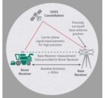
NovAtel CORRECT® is the positioning algorithm on NovAtel’s GNSS receivers that handles corrections from a variety of sources, including RTK, PPP, SBAS and DGPS. With NovAtel CORRECT®, you can choose the corrections method that best meets the requirements and performance objectives of your application.
Whether it’s an RTK solution, for highest accuracy and availability, a PPP solution when you need to meet high accuracy requirements without all the extra setup, or a simple low accuracy, lower cost solution available through SBAS/DGPS, NovAtel’s CORRECT® offers it all.
Providing a single source of GNSS hardware, correction service and support, NovAtel’s CORRECT® simplifies the process of acquiring the best possible position. NovAtel CORRECT RTK and PPP solutions are designed to work optimally together to deliver decimeter or better positioning. Most importantly, NovAtel CORRECT exemplifies NovAtel’s OEM partnership model by offering system integrators and dealers flexible, scalable and competitive positioning technology with great opportunity for future innovation.
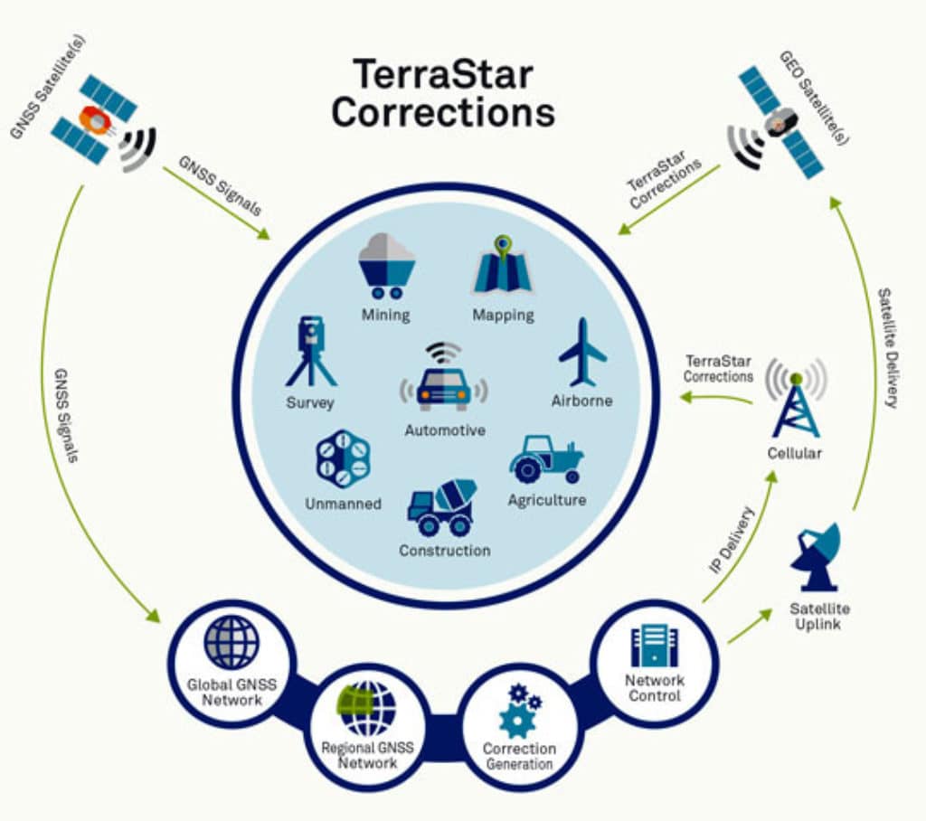
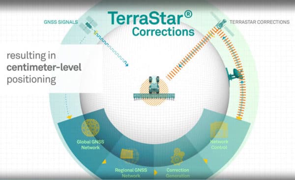
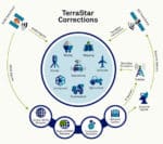
TerraStar premium GNSS corrections combined with OEM receiver technology from NovAtel offers sub-meter to centimeter-level positioning for land, unmanned and airborne applications globally. TerraStar multi-constellation corrections are available globally in four service levels, depending on your hardware and GNSS performance requirements.
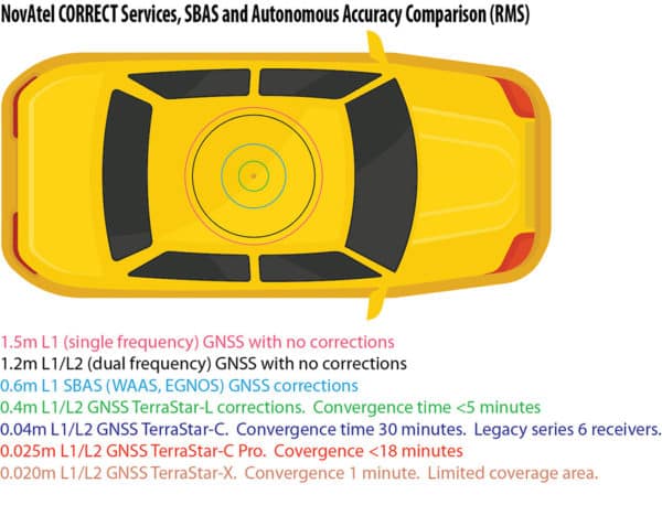
- TerraStar-X on OEM7 (2 cm accuracy < 1 minute).
- TerraStar-C PRO on OEM7 (2.5 cm accuracy < 18 minutes).
- TerraStar-C on OEM6 (4 cm accuracy < 30 minutes). (TerraStar-C was replaced by TerraStar-C Pro in 2019.)
- TerraStar-L on OEM6/OEM7 (40 cm accuracy < 5 minutes).
NovAtel Correct® Options
TerraStar Network Infrastructure. Over 100 GNSS reference stations that are located around the world are operated, maintained and controlled by TerraStar. There are six Geostationary communication satellites, which means two beams are always visible from anywhere on earth. The TerraStar network has three network control centers and back to front line support is available 24 hours a day, seven days a week.
| Performance | TerraStar-X 3 | TerraStar-L 1 | TerraStar-C 2 | TerraStar-C Pro |
| Horizontal Accuracy 3 |
2 cm (RMS) 2.5 cm (95%) |
40 cm (RMS) 50 cm (95%) |
4 cm (RMS) 5 cm (95%) |
2.5 cm (RMS) 3 cm (95%) |
| Vertical Accuracy 3 | 5 cm (RMS) | 60 cm (RMS) | 6.5 cm (RMS) | 5 cm (RMS) |
| Convergence Time 4 | <1 min | <5 min | 30-45 min | <18 min |
| Supported GNSS | GPS/GLO | GPS/GLO | GPS/GLO | GPS/GLO/GAL/BDS |
| Supported Platform | OEM7 | OEM7, OEM6 | OEM6 |
OEM7, SMART2 |
| Coverage Area | Regional | Global | Global |
Global |
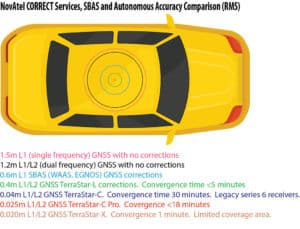
NovAtel Correct Services, SBAS and Autonomous Accuracy Comparison Chart
Benefits
- Satellite-delivered corrections eliminate the need for base station(s) and cellular network connectivity
- TerraStar corrections superior GNSS reference network, redundant system architecture, continuous quality monitoring
- High rate corrections provide rapid re-convergence, typically in less than 60 seconds following brief GNSS signal disruptions
- OEM positioning technology allows continuous operation through correction signal interruptions up to 300 seconds
- Overlapping geostationary satellite coverage ensures maximal coverage
- Triple L-Band tracking5 allows better correction signals reception even in challenging environments
- A seamlessly integrated solution from a single source including GNSS hardware and corrections
Notes
- TerraStar-L is available on OEM7 products and the following OEM6 products: OEM628, FlexPak6 and SMART6-L products.
- TerraStar-C was replaced by TerraStar-C Pro in 2019.
- Measured performance from seven-day static data. Horizontal and vertical accuracy may differ based on receiver capabilities, location, GNSS constellation health and visibility, GNSS/L-Band signal obstructions, level of multipath/interference, and local atmospheric conditions.
- Convergence times may vary by several minutes and are dependent on observing conditions including the number of visible GNSS signals, level of multipath and proximity to obstructions like large trees or buildings. TerraStar-C and PRO convergence times are specified to a horizontal accuracy of 5 cm at 95%. TerraStar-L convergence time is specified to a horizontal accuracy of 50 cm at 95%.
- Triple L-Band tracking is supported only on OEM7 platforms. Most locations have at least two geostationary satellites in view.
