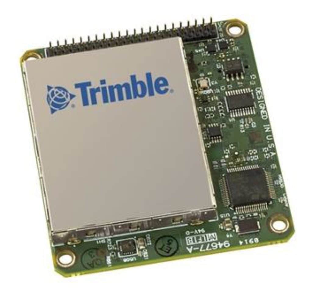
Trimble BD940-INS GNSS Receiver
Triple Frequency Receiver with Integrated Inertial Navigation System and MSS Band Demodulator
The BD940-INS integrates the latest in precision inertial sensors on the same module where robust high accuracy positions are produced in all environments. As the number of satellites in the constellations grows, the BD940-INS is ready to take advantage of the additional signals.
The Trimble BD940-INS module has been designed for applications requiring continuous centimeter accuracy in a compact package. By integrating inertial sensors on the same module, robust high accuracy positions are produced in all environments.
The GNSS components are fully shielded. This design ensures the high quality signals are protected from the sources of EMI on the host platform.
The Trimble BD940-INS integrates the latest in precision inertial sensors in a compact package. The module was designed for easy integration and rugged dependability. With the BD940-INS you are buying a robust navigation solution, not just a GNSS receiver. It delivers varying levels of performance down to centimeter level without the use of a base station.
KEY FEATURES
- Trimble Maxwell 7 Technology
- Onboard high accuracy inertial sensor package integrated with GNSS for precise position and orientation
- 336 Channels for multi-constellation GNSS support
- OmniSTAR/RTX Support
- EMI shielded module
- Compact design for mobile applications
- Flexible RS232, USB and Ethernet interfacing
- Centimeter level position accuracy
- Advanced RF Spectrum Monitoring
TECHNICAL SPECS
- Size 60 mm x 67 mm x 15 mm
- Power 5.5V DC to 30V DC
- Typical 3.5 W (L1/L2 GPS L1/L2 GLONASS)
- Weight 60 grams
- Connectors I/O: 44 pin header
- GNSS Antenna: MMCX receptacle
- Antenna LNA Power Input: Input voltage: 3.3V DC to 5V DC
- Maximum current: 400 mA
- Minimum required LNA Gain: 31.0 dB
ProPoint(TM) Engine
Trimble® ProPoint™ Positioning Engine
Trimble® ProPoint high-precision positioning engine provides position and orientation data from the fusion of (1) GNSS signals, (2) globally accessible high-accuracy correction services, and (3) measurement data from a variety of sensors. It leverages the latest in GNSS signal infrastructure and Trimble’s high-precision receiver hardware to deliver improved positioning performance in challenging environments. It also contains dynamic models of specific application movements allowing it to filter out unexpected dynamic movements, such as with a bulldozer sliding sideways during operation, for improved accuracy.
Improved RTK Accuracy
- Improved RTK and Trimble RTX® performance in challenging environments where satellite line of sight can be impaired, such as under tree canopy, highway overpasses, and in dense urban areas.
- Sensor Fusion using tighter integration of GNSS and IMU (and new technologies in the future) to provide continuous position and orientation solution.
- Dynamic models tuned to specific applications such as automotive vs off-road vs marine for enhanced performance.
Increased Availability
- Independent tracking loop to enable tracking of L2C, L5 signals in the solution if L1 is jammed.
- Robust GNSS performance under harsh conditions such as canopy and urban environments.
- Reduced convergence times (<1 min in RTX-Fast regions) by utilizing multi-constellation signals from GPS, Galileo, GLONASS, BeiDou and QZSS
Better Integrity
- Advanced signal filtering and error modeling means better protection against jamming, spoofing and multipath interference.
- Improved satellite health reporting to better handle unforeseen constellation outages.
- Incorporation of Galileo NeQuick ionospheric model results in better resiliency.
Enhanced Constellation Support
- Implementation of all open BeiDou3 signals in RTK and RTX solution.
- Support for E6 data channel on Gen-II QZSS satellite signals.
- NAVIC support for correction formats.


