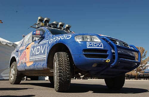
2018 finds driverless cars in various advanced testing stages—with multiple companies focused on bringing driverless cars to public roads. Much of that progress results from an innovative race that began in 2004, The DARPA Grand Challenge.
Funded by the Defense Advanced Research Projects Agency with the goal of accelerating the development of autonomous vehicle technology, the Grand Challenge was the first long-distance race for autonomous vehicles. The original challenge course ran from Bristow, CA to Primm, NV—some 150 miles across the Mojave Desert region.
The prize: $1 million dollars. But before there could be a race, the course needed to be mapped to a high accuracy—a process that posed several unique challenges. DARPA knew external GNSS expertise was needed, and it chose NavtechGPS for the job.

Gathering info and creating the course map, which DARPA would disseminate to participants through a GIS-like system, required precise mapping of the latitude, longitude and altitude of obstacles, hills, and other environmental features.
The desert location, while ideal for the fledgling race because it was free of buildings, traffic and people, did not offer surveyed landmarks for validating coordinates. NavtechGPS was able to solve this.
As temperatures rise through the day, the sun warms the ionosphere above the GPS user, and it bends in a mostly unpredictable way. The longer path causes an increased length of travel for an RF satellite signal. Because the signal now takes several nanoseconds longer to arrive at the user’s antennae, the position becomes inaccurate, usually by several feet. In fact, a difference of one billionth of a second can throw off measurement by 12 inches; a delay of nine nanoseconds can result in a discrepancy of 19 feet. This refraction mostly impacts GPS receivers using single frequency receivers (like GPS in cars or smart phones).
With 2004 technology, handheld GPS receivers were available, but they did not deliver the accuracy needed for mapping the course. In fact, L1 (single frequency) receivers had a margin of error of two to three meters (six to nine+ feet) at the time. NavtechGPS recommended dual frequency receivers, which used a second GPS frequency (L2) and autonomously delivered accuracy within one meter and eliminated ionospheric issues.
But because the Grand Challenge course required even more accurate measurements and positioning, NavtechGPS recommended a private SBAS (Satellite Based Augmentation System) instead of local reference stations because of the large area being covered.